
Van Buren County’s Remonumentation Program is dedicated to restoring and preserving the original survey markers that define property boundaries across the county. These historic markers, set in place during Michigan’s first land surveys in the 1830s, are the foundation of property ownership and land division throughout the county. However, after almost two centuries, many markers have been lost, damaged, or shifted over time, which can lead to property boundary disputes and inaccuracies.
The Survey and Remonumentation Act of 1990 was created to address this issue across Michigan. For the first time since the original survey, state and county authorities are working together to locate, restore, and protect these public land survey corners, making sure they’re accurately marked and documented for current and future generations.

Why Remonumentation is Important
Remonumenting the county’s survey corners has multiple benefits:
Protecting Property Ownership: Clearly marked boundaries prevent disputes, protecting the rights of landowners.
Supporting Public Services: Accurate land boundaries improve emergency response and planning by providing precise location data.
Preserving Local History: The original land markers connect us to Michigan’s early days, and maintaining them preserves that historical link.
In Van Buren County, remonumentation covers approximately 2,333 survey corners that need restoration. Each corner is assigned modern coordinates for ongoing accuracy and easier location, forming a comprehensive system that is carefully maintained.
How Remonumentation Works in Van Buren County
The physical process of remonumentation combines historical research with modern technology, bringing together surveyors who work meticulously to ensure accuracy and consistency.
Historical Research and Document Review: Surveyors start by studying original land survey records and historic maps to understand where each corner should be located. These records often include details about trees, streams, or other landmarks that existed in the 1830s.
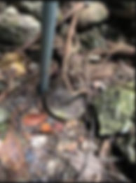
Field Investigation: Equipped with historic information, surveyors head to the field to locate the original corners. They use metal detectors and other tools to search for remnants of old monuments. When the original markers are missing, they search for nearby “witness” markers—secondary markers placed at a set distance from the main corner, which can help triangulate its location.

Precision with GPS and Survey Equipment: Once a corner’s location is verified, surveyors use high-accuracy GPS and total stations to assign modern coordinates to each point. By tying each marker to the Michigan Coordinate System, they ensure it aligns with both historic data and today’s mapping requirements.

Setting New Monuments: Surveyors set new, permanent markers at each corner. These new monuments, often made from durable materials like stainless steel or brass, are embedded securely to withstand environmental conditions and maintain accuracy.
Documentation and Public Access: Each restored corner is thoroughly documented, with information on coordinates, descriptions, and field notes added to county records. The updated data is also available in the Public Land Survey System & Remonumentation Viewer, a public tool that helps residents, surveyors, and property owners verify land boundaries.

Land Corner Recordation Certificate (LCRC) Peer Review for Accuracy: To ensure precision, Van Buren County has organized a Peer Group of licensed surveyors who meet 4-6 times per year to review and reach a consensus on each remonumented corner. These meetings are typically held on the last Tuesday of the month at 7:00 pm in the Donald Hanson Board of Commissioners Room. Residents can check the County’s Public Meeting Notice page for updates on dates and locations.
The Role of County Surveyor and the Digital Information Department (DID)
The County Surveyor oversees all remonumentation activities, ensuring that each restored marker aligns with state guidelines. Van Buren County’s DID manages the annual State of Michigan Remonumentation Grant, which funds most of this extensive work. Together, the Surveyor’s Office and the DID coordinate to keep the remonumentation program moving forward, using state-of-the-art tools and historic records to preserve the integrity of the county’s land markers.
How to Access Remonumentation Data
To stay informed about the status of remonumented corners, residents can visit the Public Land Survey System & Remonumentation Viewer. This interactive online tool shows the exact coordinates and status of each government corner, making it easy for residents, land developers, and surveyors to verify property boundaries and corner locations.

Connecting the Past to the Future
Van Buren County’s Remonumentation Program is more than just a technical project—it’s a bridge between history and modern land management. By preserving these historic markers, the county is ensuring the accuracy and integrity of property boundaries for generations to come. Through a blend of careful research, precision technology, and community oversight, the program supports the entire county in maintaining reliable, well-documented land boundaries.
For more details or to follow the program’s progress, visit the Van Buren County Public Meeting Notice page and the Remonumentation Viewer.


